Turn your phone into a real off-road GPS using offline topo maps with AlpineQuest, the ultimate tool for all your outdoor adventures. Whether you're hiking, running, trailing, hunting, sailing, geocaching, or navigating off-road, AlpineQuest has you covered.
No advertisements ~ No data sharing & monetization ~ No analytics ~ No third party libraries
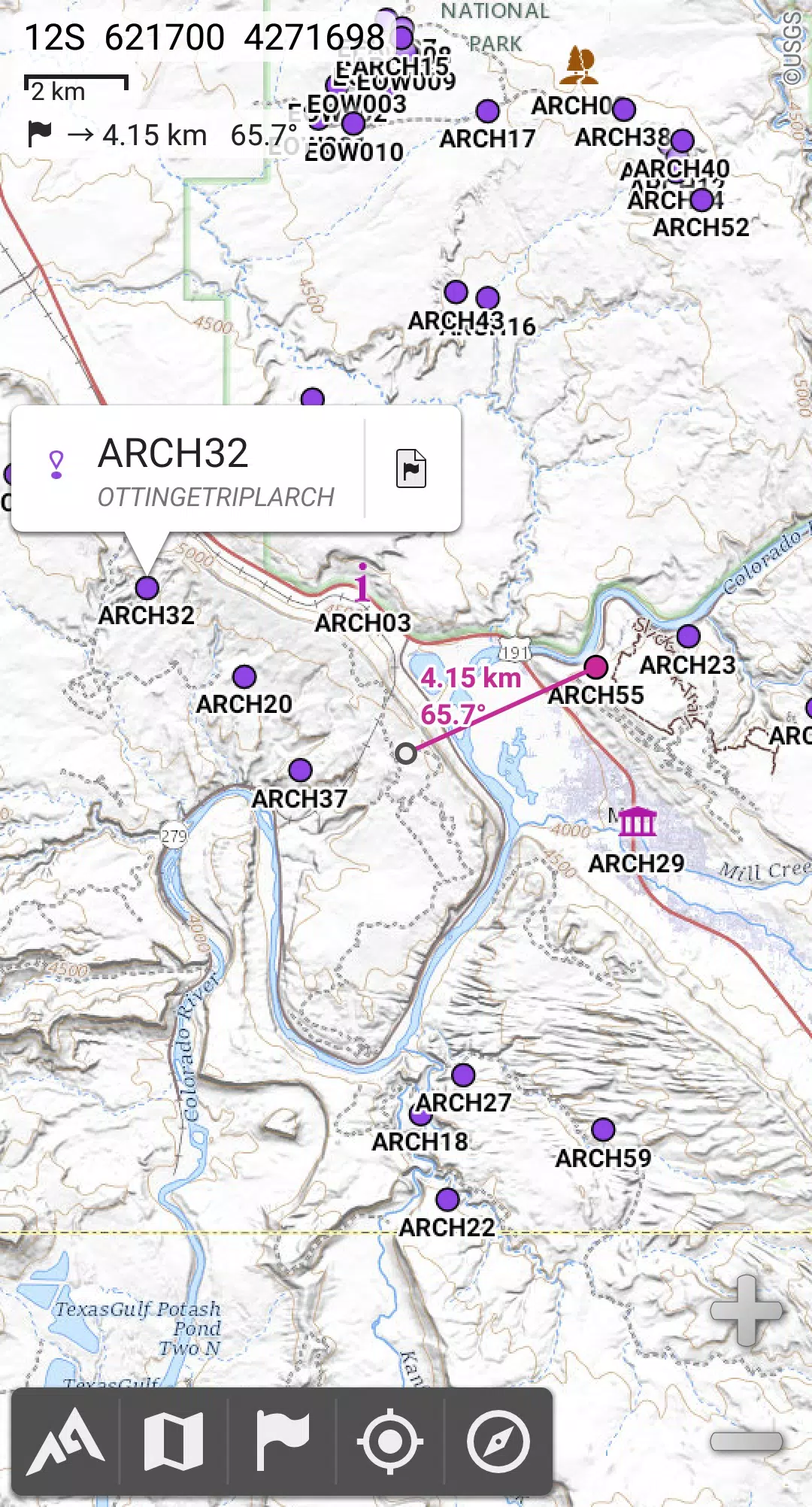
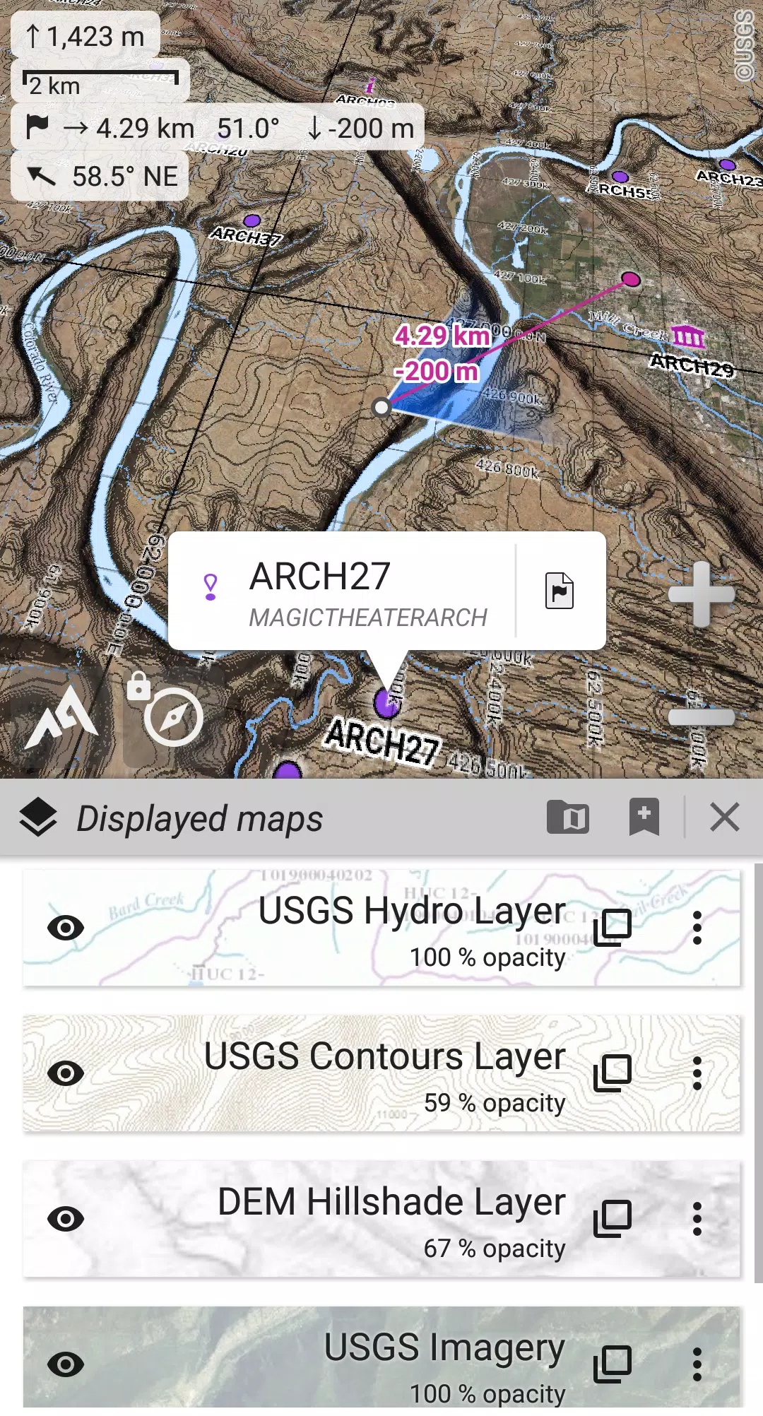
With AlpineQuest, you can access and store a wide range of online topographic maps locally, ensuring they remain available even when you're out of cell coverage. The app also supports numerous onboard file-based raster map formats, making it versatile for any terrain.
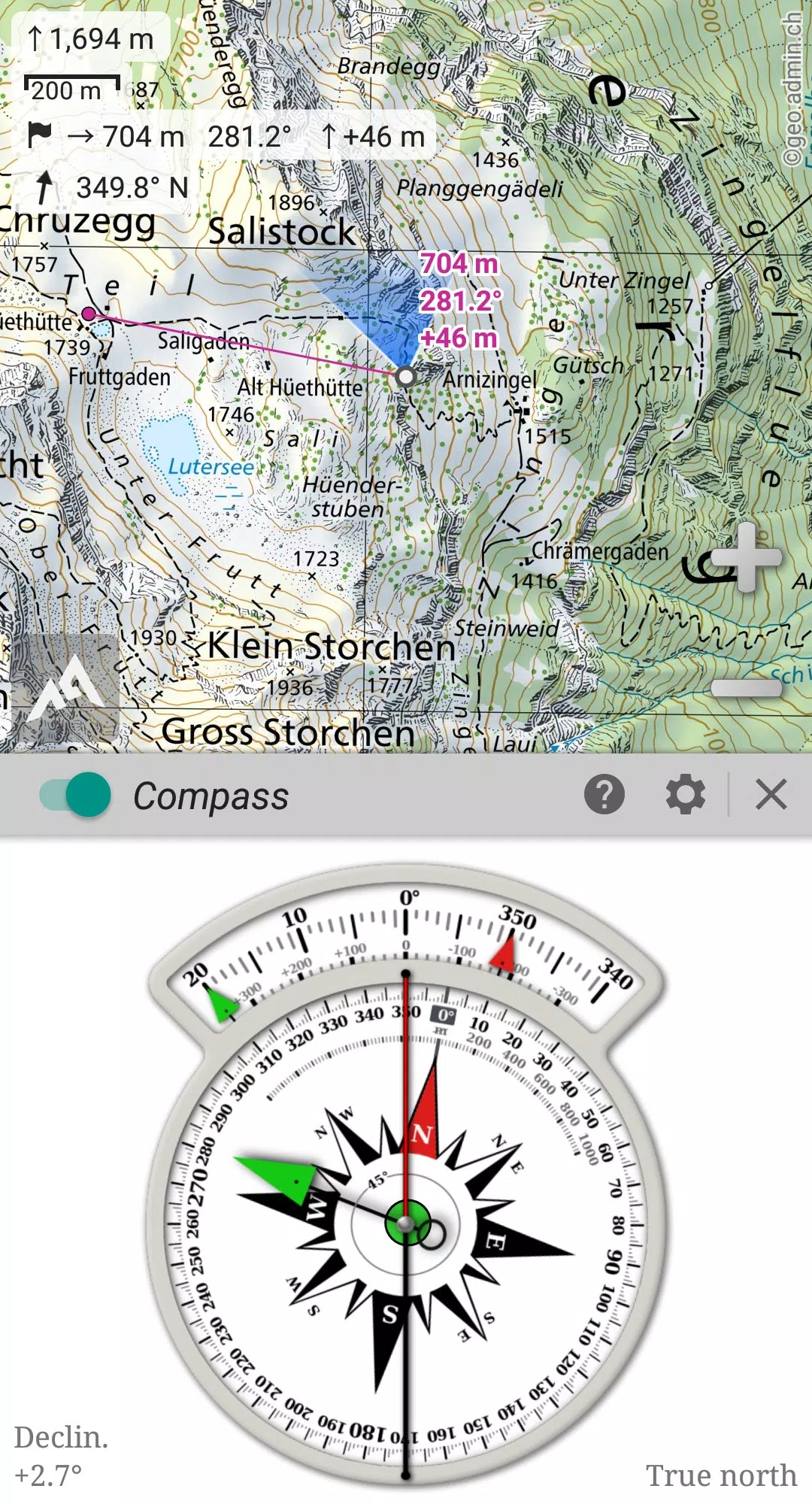
Using your device's GPS and magnetic sensor, AlpineQuest provides real-time localization on the map. The compass display helps orient the map to match your current view, making it easier to navigate without getting lost.
Save and retrieve unlimited placemarks, share them with friends, and track your path with advanced statistics and interactive graphics. AlpineQuest's comprehensive features ensure you can accomplish all your outdoor goals.
Designed to function fully without cell coverage, AlpineQuest is perfect for exploring deep wilderness, whether in the mountains or abroad.
Don't hesitate, try the Lite version for free right now!
For any suggestions or issues, please visit our dedicated forum at https://www.alpinequest.net/forum (no registration needed, all questions answered) instead of leaving comments.
Key features (available in the full version) include:
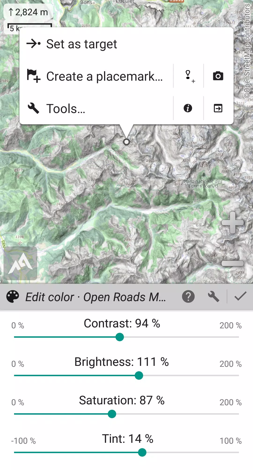
★★ Maps ★★
★★ Placemarks ★★
★★ GNSS Position / Orientation ★★
★★ And More ★★
Last updated on Aug 14, 2024
2.3.8b/c/d
Girls Frontline 2: Exilium Global Website Goes Live, Along With Its Socials!
Marvel Rivals: Understanding Bussing and Catching It
New Game Plus in Assassin's Creed Shadows: Confirmed?
Top Skills to Prioritize for Yasuke in Assassin’s Creed Shadows
Death Stranding 2 Release Date Unveiled in Massive Trailer
Assassin’s Creed Shadows Movements Reviewed by Two Parkour Athletes
Pokemon GO Leak Teases New Adventure Effects
Amazon Music Unlimited: Free 3-Month Trial Available

Fantastic Four Trailer Reveals Silver Surfer Amid Galactus Threat
May 27,2026

Legend of Zelda: Age of Imprisonment Declared Canon
May 27,2026

Rust Mobile drops a brand new trailer ahead of its appearance at Gamescom 2025
May 25,2026

Oni Press Unveils Mind-Bending Series Inspired by Philip K. Dick
May 22,2026

Monster Hunter Board Game: Guide & Expansions
May 22,2026
 Category

 Download


Discover the best professional photography software! This comprehensive review features top-rated apps like ReLens Camera, PhotoKit AI Photo Editor, Pixlr, YouCam Perfect - Photo Editor, GCamera: GCam & HD Pro Photos, Photo Studio PRO, Lightleap by Lightricks, Google Camera, PhotoShot, and Photoroom. Compare features, user reviews, and pricing to find the perfect app for your photography needs, whether you're a beginner or a pro. Enhance your images with AI-powered tools, advanced editing capabilities, and stunning filters. Elevate your photography game today!
Photoroom AI Photo Editor
Photo Studio PRO
ReLens Camera
Pixel Camera
Pixlr – Photo Editor
YouCam Perfect - Photo Editor
PhotoKit AI Photo Editor