Lifestyle 4.7.4 44.10M by Digital App Valley ✪ 4.3
Android 5.1 or laterMar 20,2025
 Download
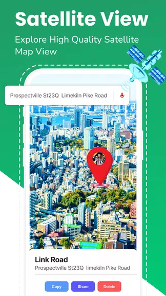
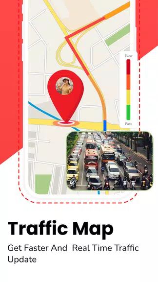
Navigate effortlessly with GPS Satellite Maps: Live Earth, your ultimate navigation solution. Never get lost again with live traffic updates, precise driving directions, and convenient voice navigation. Whether driving, cycling, or walking, enjoy seamless turn-by-turn guidance to your destination. Discover new places, avoid traffic congestion using real-time GPS, and explore public transport with integrated subway maps. Our intuitive interface and constantly updated maps guarantee accuracy and reliability on every journey.
Comprehensive Navigation: GPS Satellite Maps: Live Earth provides a full suite of navigation tools for efficient and smooth journeys.
Real-Time GPS Navigation: Stay on course with current maps and live traffic updates, ensuring you always find the best path.
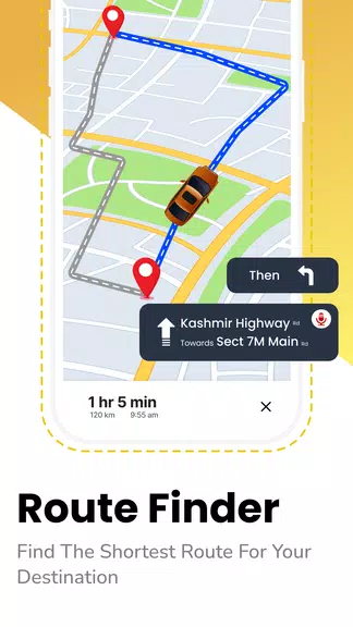
Intelligent Route Planning: Effortlessly find the quickest route with just a few taps; let the app optimize your journey.
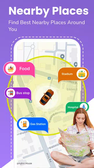
Extensive Points of Interest (POIs): Discover nearby attractions, restaurants, shops, and more – all easily accessible within the app.
Is the app user-friendly? Yes, GPS Satellite Maps: Live Earth features an intuitive interface designed for simple and seamless navigation.
Does the app include subway maps? Yes! Access detailed metro maps for major global cities, including route and station information.
Can I personalize my routes? Absolutely. Our advanced driving directions allow route customization based on your preferences and needs.
Experience confident and convenient navigation with GPS Satellite Maps: Live Earth. From daily commutes to exploring new cities or planning road trips, our app simplifies every journey. Real-time GPS, intelligent routing, and a comprehensive database of points of interest ensure you'll never be lost. Download today and enjoy effortless navigation at your fingertips.
Girls Frontline 2: Exilium Global Website Goes Live, Along With Its Socials!
Marvel Rivals: Understanding Bussing and Catching It
New Game Plus in Assassin's Creed Shadows: Confirmed?
Top Skills to Prioritize for Yasuke in Assassin’s Creed Shadows
Death Stranding 2 Release Date Unveiled in Massive Trailer
Assassin’s Creed Shadows Movements Reviewed by Two Parkour Athletes
Pokemon GO Leak Teases New Adventure Effects
Amazon Music Unlimited: Free 3-Month Trial Available

Rust Mobile drops a brand new trailer ahead of its appearance at Gamescom 2025
May 25,2026

Oni Press Unveils Mind-Bending Series Inspired by Philip K. Dick
May 22,2026

Monster Hunter Board Game: Guide & Expansions
May 22,2026
Ragnarok M Eternal Love Class Tier List - The Best Classes in the Game (Updated July 2025)
May 21,2026

MLBB Lite Launches in Africa
May 14,2026
 Category


Discover the best professional photography software! This comprehensive review features top-rated apps like ReLens Camera, PhotoKit AI Photo Editor, Pixlr, YouCam Perfect - Photo Editor, GCamera: GCam & HD Pro Photos, Photo Studio PRO, Lightleap by Lightricks, Google Camera, PhotoShot, and Photoroom. Compare features, user reviews, and pricing to find the perfect app for your photography needs, whether you're a beginner or a pro. Enhance your images with AI-powered tools, advanced editing capabilities, and stunning filters. Elevate your photography game today!
Photoroom AI Photo Editor
Photo Studio PRO
ReLens Camera
Pixel Camera
Pixlr – Photo Editor
YouCam Perfect - Photo Editor
PhotoKit AI Photo Editor