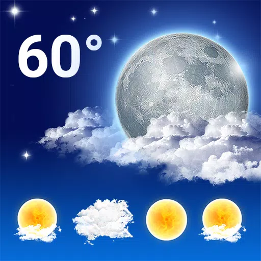
Zoom Earth is your go-to interactive global weather map and real-time hurricane tracker, designed to keep you informed about hurricanes, typhoons, and tropical cyclones as they happen. With an array of features including satellite imagery, rain radar, weather forecast maps, and more, it ensures you stay one step ahead of the weather.
Key Features
Satellite Imagery: Experience weather maps enriched with near real-time satellite imagery sourced from NOAA GOES, JMA Himawari, EUMETSAT Meteosat, and NASA's Aqua and Terra polar-orbiting satellites. This gives you a comprehensive view of weather patterns across the globe.
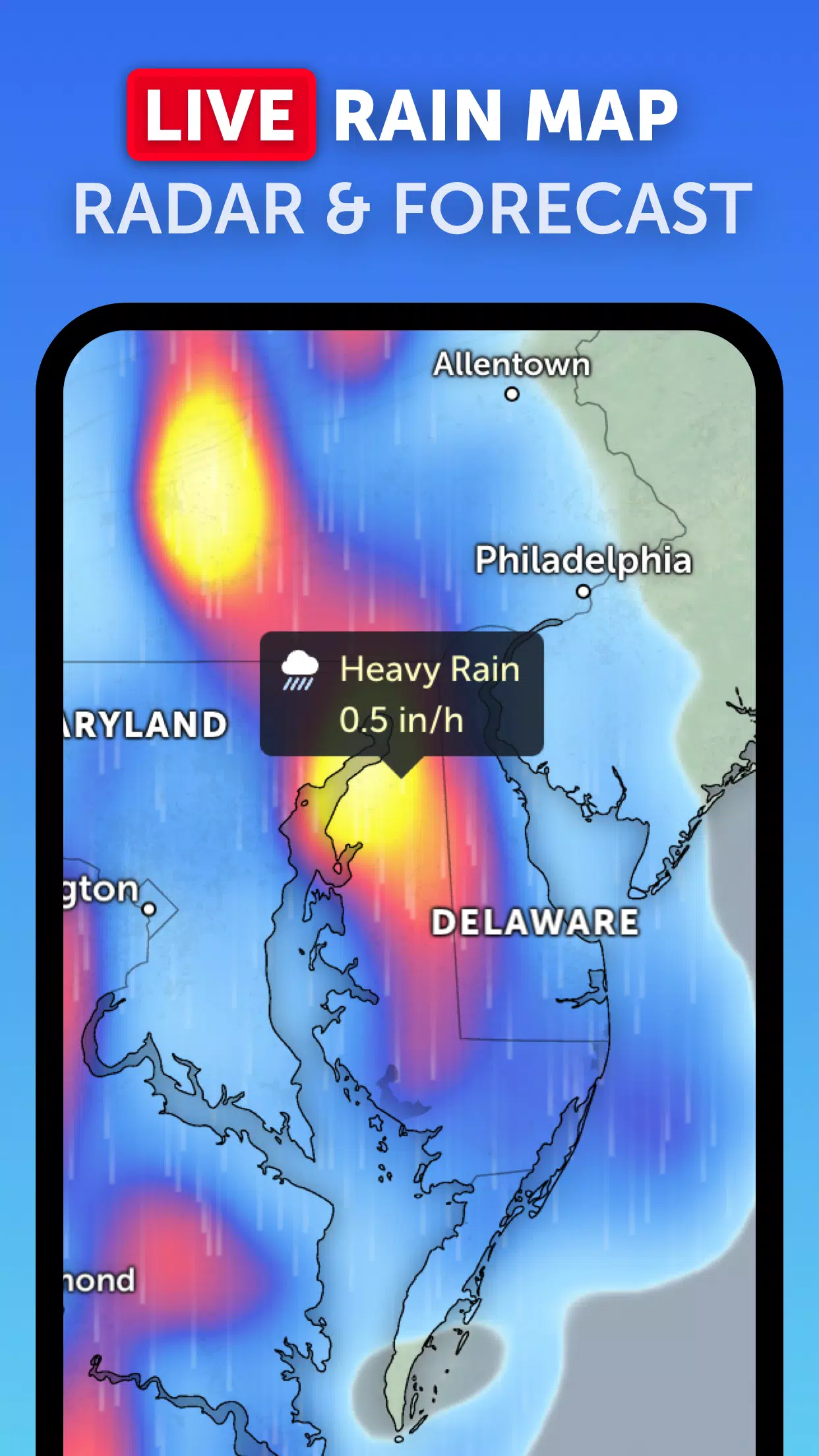
Rain Radar: Stay ahead of the storm with our detailed weather radar map. This feature displays rain and snow detected by ground-based Doppler radar in real-time, ensuring you're always prepared for what's coming.
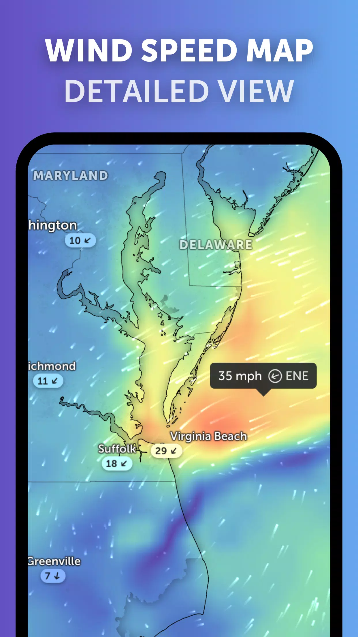
Weather Forecast Maps: Dive into our visually stunning and interactive global forecast maps. These maps provide detailed forecasts on precipitation, wind speed and gusts, temperature, "feels like" temperature, relative humidity, dew point, and atmospheric pressure, helping you plan your activities with confidence.
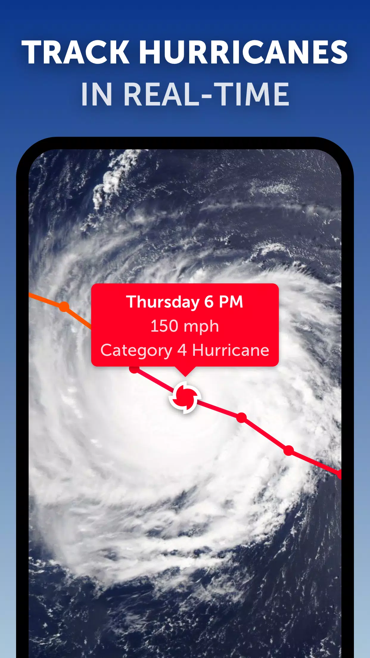
Hurricane Tracking: Keep a close eye on hurricanes from their inception to their peak as category 5 storms with our state-of-the-art tropical tracking system. We leverage the latest data from NHC, JTWC, NRL, and IBTrACS to deliver accurate, real-time tracking.
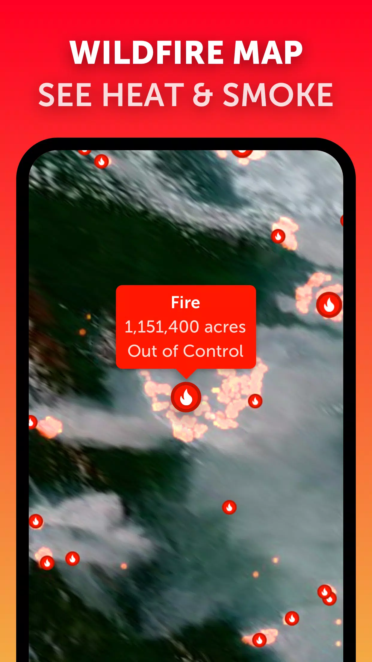
Wildfire Tracking: Monitor wildfires with ease using our active fires and heat spots overlay. This feature highlights areas of very high temperature detected by satellite, updated daily with data from NASA FIRMS, keeping you informed about fire outbreaks worldwide.
Customization: Tailor your experience with our extensive customization options. Adjust temperature units, wind units, time zone, animation styles, and much more to fit your preferences.
Last updated on Sep 19, 2024
Zoom Earth's latest updates and comprehensive features make it an essential tool for tracking hurricanes, typhoons, and tropical cyclones in real-time, ensuring you're always informed and prepared.
Girls Frontline 2: Exilium Global Website Goes Live, Along With Its Socials!
Marvel Rivals: Understanding Bussing and Catching It
New Game Plus in Assassin's Creed Shadows: Confirmed?
Top Skills to Prioritize for Yasuke in Assassin’s Creed Shadows
Assassin’s Creed Shadows Movements Reviewed by Two Parkour Athletes
Death Stranding 2 Release Date Unveiled in Massive Trailer
Pokemon GO Leak Teases New Adventure Effects
Amazon Music Unlimited: Free 3-Month Trial Available

Divinity Is Revealed As The TGA 2025 Hellstone Statue
May 29,2026
Bungie Initiates 'Thorough Review' After Uncredited Art Discovery
May 29,2026

Fantastic Four Trailer Reveals Silver Surfer Amid Galactus Threat
May 27,2026

Legend of Zelda: Age of Imprisonment Declared Canon
May 27,2026

Rust Mobile drops a brand new trailer ahead of its appearance at Gamescom 2025
May 25,2026
 Category

 Download


Discover the best professional photography software! This comprehensive review features top-rated apps like ReLens Camera, PhotoKit AI Photo Editor, Pixlr, YouCam Perfect - Photo Editor, GCamera: GCam & HD Pro Photos, Photo Studio PRO, Lightleap by Lightricks, Google Camera, PhotoShot, and Photoroom. Compare features, user reviews, and pricing to find the perfect app for your photography needs, whether you're a beginner or a pro. Enhance your images with AI-powered tools, advanced editing capabilities, and stunning filters. Elevate your photography game today!
Photoroom AI Photo Editor
Photo Studio PRO
ReLens Camera
Pixel Camera
Pixlr – Photo Editor
YouCam Perfect - Photo Editor
PhotoKit AI Photo Editor